Marport TE/Nøgd spart okkum fyri nakrar 100 túsund henda túrin
05. Sep 2019
Hetta sigur ein vælnøgdur Bjarni Petersen, skipari á Arctic Viking um Marport TE/Nøgd.
Hetta sigur ein vælnøgdur Bjarni Petersen, skipari á Arctic Viking um Marport TE/Nøgd.
Kajak rógvarar á Raymarine QUANTUM radara.
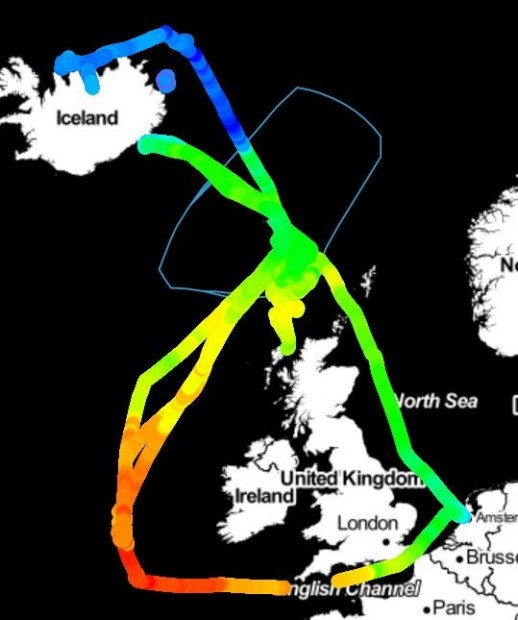
Until today, fishing vessels have been using satellites for mapping the ocean surface temperature
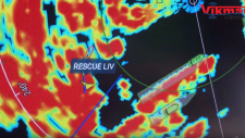
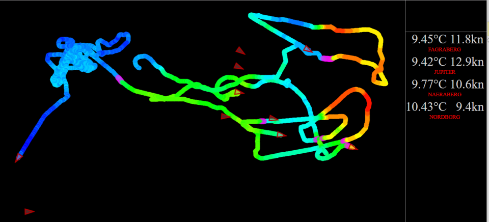
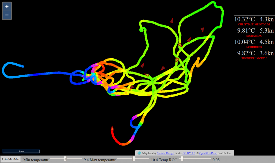
VikHub is the first LIVE temperature mapping system for fishing vessels!
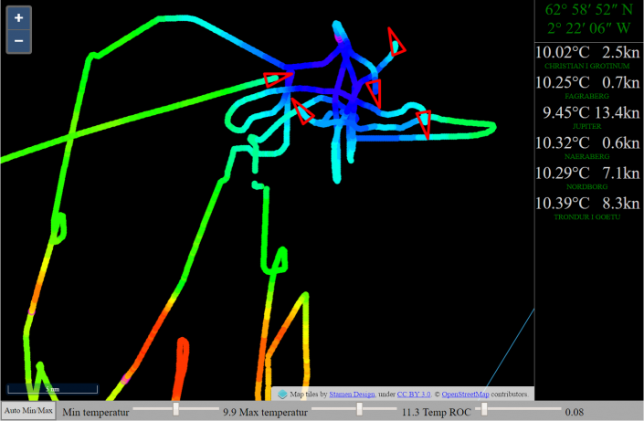
Many fish species follow the ocean temperature.
VikHub is mapping the ocean temperature with live data from fishing vessels.
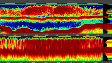
VikHub is not only mapping the temperature on the surface.
VikHub is also mapping the temperatur close to the bottom!
Contact Vikmar to learn more about VikHub for surface & bottom temperature mapping


|
Vikmar | Tel. 612182 | Fax 35 2183 | info@vikmar.fo
|


|